TRAIL DATA & MAP LAYER SUPPORT
Drumroll please…
Our custom KML Integration allows us to show these geographic data files overlaid on the map experience of the widget and apps. This offers a way to highlight your regions and attractions more prominently and accurately than ever before. Clients are using these to highlight different geographic regions of their target market by color, shading, or boundary, outline hiking, biking and horse trails on the map, and distinguish their community from the others surrounding it, making it easier for visitors and residents to navigate each community’s unique offerings.
Below details just a few creative ways our clients are utilizing this functionality.
Neighborhoods/Regions
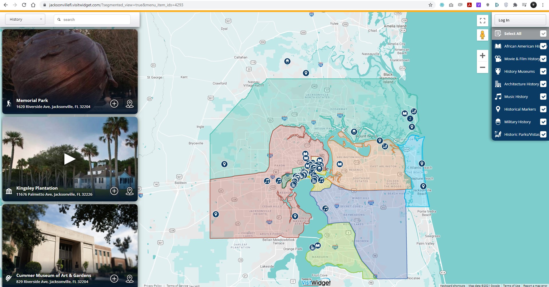
Neighborhood Example: https://jacksonvillefl.visitwidget.com/?segmented_view=true&menu_item_ids=4293
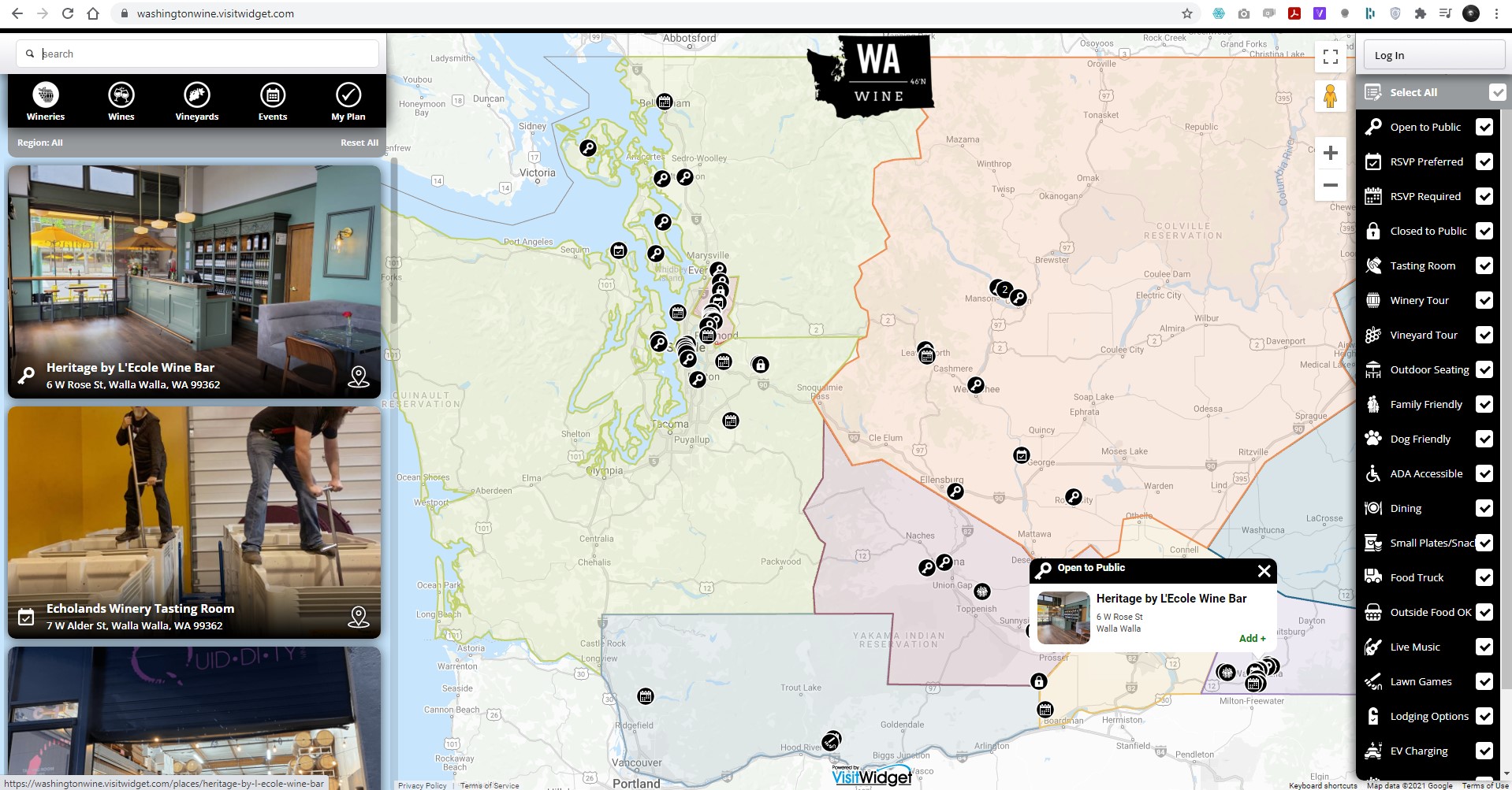
Regional Example: https://washingtonwine.visitwidget.com/
Highlighting different neighborhoods and/or regions educates your users about your community right when they open the widget. Use this to call out an art or historic district, regional attraction, geographically unique region, etc to direct your user’s attention right away. Jacksonville FL uses this feature to identify the different historic districts throughout the city, while Washington Wine is able to show users where the different wine tasting regions and AVAs are without ever having to leave the widget or apps. It’s a powerful and easy way to educate users instantly about your community!
Hiking/Biking Trails
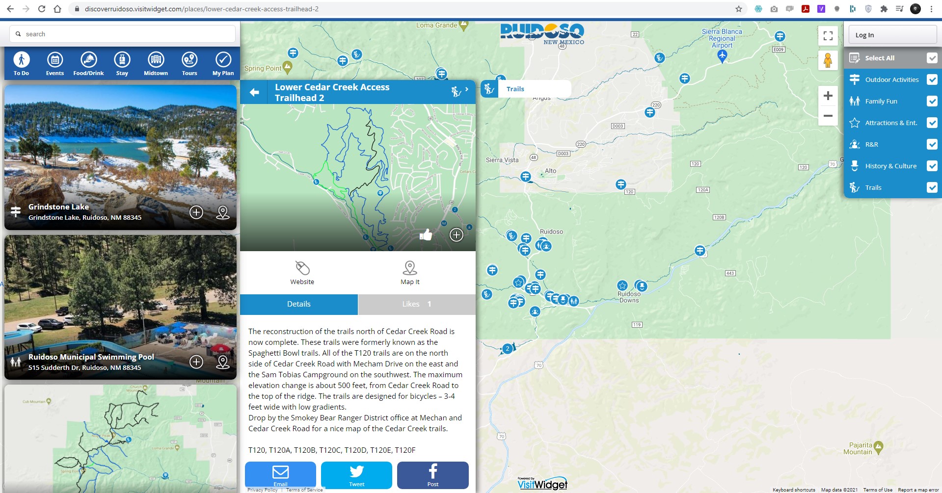
Example: https://discoverruidoso.visitwidget.com/places/lower-cedar-creek-access-trailhead-2
Navigating a hiking/biking trail is definitely not easy. You use a mapping service for directions to the trailhead, then hope for a well defined trail in nature to guide you through your hike. Especially in a new area! With KML overlays, however, Visit Widget gives users the ability to not only get to the trailhead, but once they’re there, they can use the app throughout their hike to make sure they’re on the right path. With the ability to customize the type of overlay we use, you can also color code trails to let users know which trails are easy, moderate or difficult just from looking at the map.
Highlighting your community
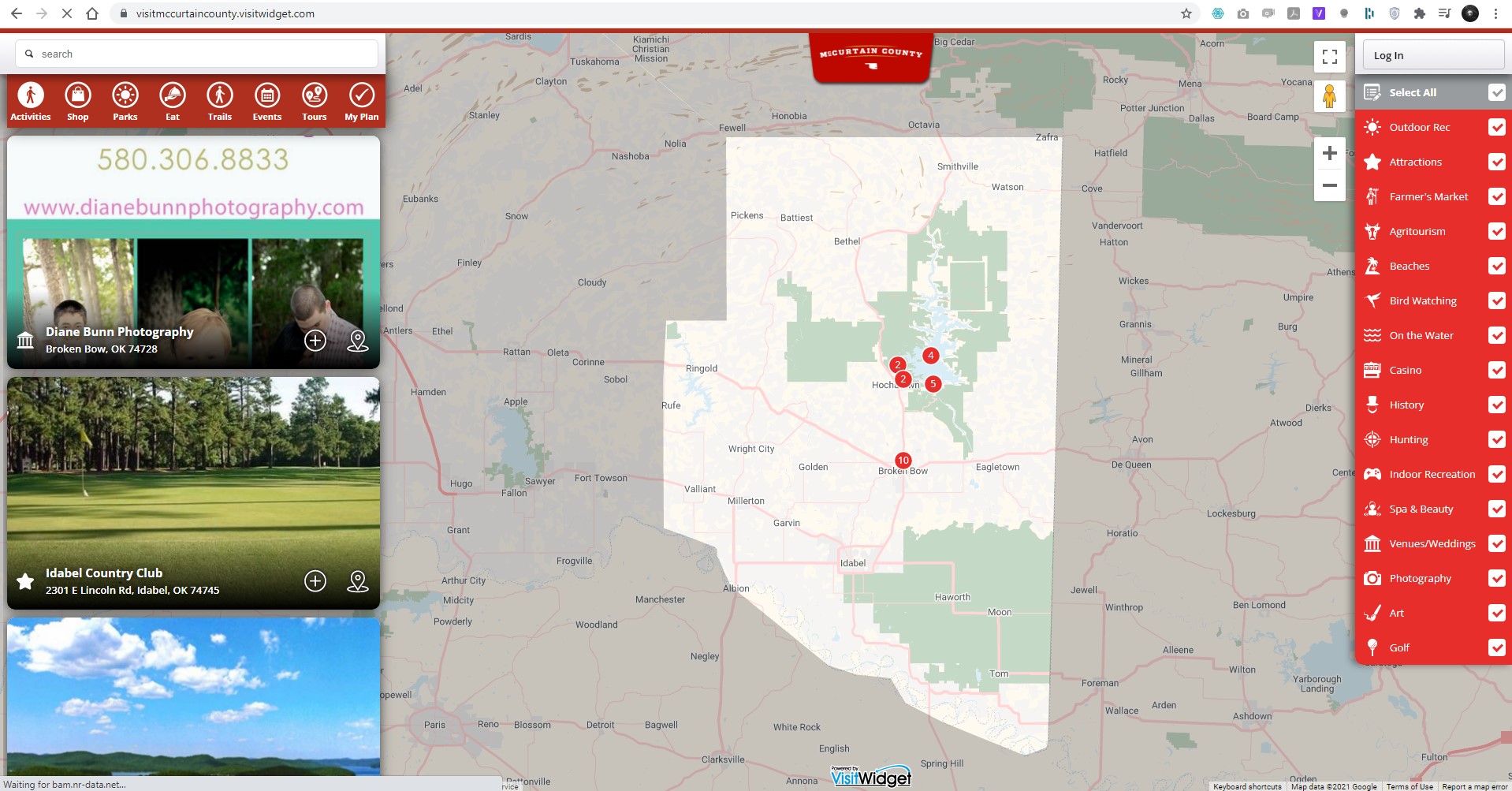
Example: https://visitmccurtaincounty.visitwidget.com/
From a map view, it can be hard to distinguish where your community ends and the next one begins. We can use KML files to outline your geographic region, calling it out by using a darker shade on the rest of the world. This helps to really let people know how far you reach and what to expect when browsing what you have to offer!
As mentioned before, the sky is the limit when it comes to what a KML overlay can show. Reach out to your Account Manager to discuss the options for your community!
For questions or more information, reach out to your account manager or contact us here.


